Hydrologic Information Systems
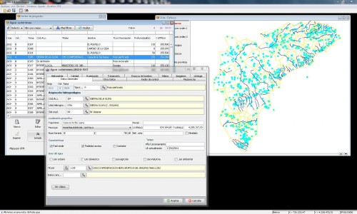
All the information about resources and hydrological infrastructures in the province of Alicante is inventoried in the Hydrological Information System of the Area of Hydrologic Cycle. This system consists of a set of software tools and management procedures that allow the storage, update and use of hydrological information, stored in georeferenced alphanumeric databases.
The system is operated through various applications that permit:
– Introducing and processing of new data
– Visualizing new charts
– Designing and printing new charts and maps
– Hydrological and hydrogeological modeling
The province’s resources and infrastructures have been represented as georeferenced entities with associated information, which can be classified in different areas:
-Hydraulic infrastructure and associated databases: hydraulic lines, climate stations, sewage treatment plants, gauging station, purification, groundwater points, water intakes, reservoirs, etc.
-Hydrologic Cartography: Basins and sub-basins, reservoirs, aquifers, permeable outcrops, hydrogeological units, drainage network.
– Basic Cartography: Municipal terms, land use, altimetry, water exploitation systems, water demand units (for agricultural, urban or industrial purposes).
Part of this system has been adapted to be used via internet.


